Booking for : Safari Cairo Wadi Elhittan Over Day
Safari Cairo Wadi Elhittan Over Day
Tour Details
Al Fayyum is an oasis and a distinctive region in character between the main Nile Valley and other desert oases: its fields are watered by a channel of the Nile, the Bahr Yussef, as it drains into a desert depression to the west of the Nile Valley. The Bahr Yussef veers west through a narrow neck of land north of Ihansya, between the archaeological sites of Lahun and Gurob near Hawara; it then branches out, providing rich agricultural land in the Al Fayy
basin, draining into the large saltwater Al Fayyum lake; the lake was freshwater in prehistory, known as Lake Moeris. The capital of Al Fayyum, Medinet – Al Fayyum, is 81 mi (130 km) southwest of Cairo The Al Fayyum proper is an oasis in the Lybian Desert, its eastern border being about 15 mi west of the Nile.
The first fossil vertebrate discovery made in Al Fayyum was of whales’ by a German geologist named Georg Schweinfurth in 1879. His find was published in 1882. In 1898, with Egypt under British military rule, Egyptian Survey geologist Hugh J.L. Beadnell was sent in to survey the Fayoum and soon found more fossil vertebrates. British Museum of Natural History paleontologist Charles W. Andrews joined Beadnell in 1901 to help make
the first extensive fossil collection from the Fayoum. They published their impressive results shortly thereafter and aroused world attention. A German team, led by Stuttgart’s Eberhard Fraas and Richard Markgraf who had moved to the Fayoum, followed the British in 1905. Now the Americans were compelled to have their own look Having an area of 490 mile² (1,270 km²).
Southwest of the Al Fayyum, and forming part of the governorate, is the Gharak depression. Another depression, entirely barren, the Wadi Rayan, covering 280 mile² (725 km²), lies west of the Gharak. The whole region is below sea-level, and, except for the gap mentioned, is encircled by the Libyan hills. The lowest part of the province, the north-west end, is occupied by the Birket ci Kerun, or Lake of the Horns, whose surface level is 140ft
below sea-level. The lake covers about 78 mile² (200 km²) Differing from the typical oasis, whose fertility depends on water obtained from springs, the cultivated land in the Al Fayyum is formed of Nile mud brought down by the Bahr Yusuf. From this channel, 15 miles (24 km) in length from Lahun, at the entrance of the gap in the hills, to Medina, several canals branch off and by these, the province is irrigated, the drainage water flowing into the Birket ci Kerun.
Over 400 mile² (1,000 km²) of the Al Fayyum is cultivated, the chief crops being cereals and cotton. The completion of the Aswan first dam by ensuring a fuller supply of water enabled 20,000 acres (80 km²) of land, previously unirrigated and untaxed, to be brought under cultivation in the three years 1903-1905. Three Crops are obtained in twenty months. The province is noted for its figs and grapes, the figs being of exceptional quality.
Olives are also cultivated. Rose trees are very numerous and most of the attar of roses of Egypt is manufactured in the province. The Fayyum also possesses an excellent breed of sheep. Lake Kerun abounds in fish, notably the bulti (Nile carp), of which considerable quantities are sent to Cairo.
Al-Fayyum city (or Medina), the capital of the province, is a great agricultural center, with a population that increased from 26,000 in 1882 to 37,320 in 1907, and has several large bazaars, mosques, baths and a much-frequented weekly market. The Bahr Yusuf runs through the town, its banks lined with houses. There are two bridges over the stream: one of three arches, which carries the main street and bazaar, and one of two
over which is built the Kait Bey mosque. Mounds north of the town mark the site of Arsinoe, known to the ancient Greeks as Crocodilopolis, where in ancient times the sacred crocodile kept in the Lake of Moeris was worshipped. Besides Medina, there are several other towns in the province, among them Senuris and Tomia to the north of Medina and Senaru and Auuksa on the road to the lake. There are also, especially in the neighborhood of the lake, many ruins of ancient villages and cities. The Fayum is the site of Lake Moeris of the ancient Egyptians, a lake of which Birket ci Kerun is the shrunken remnant.
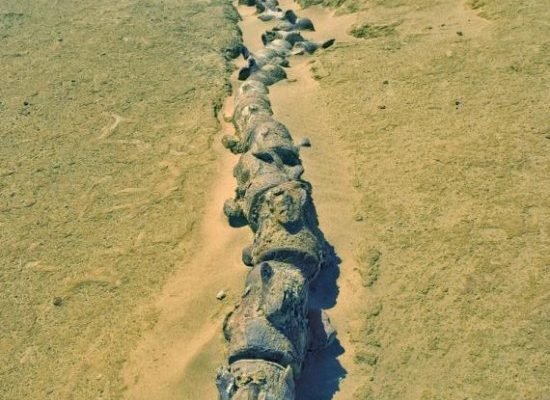
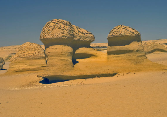
Wadi Hittan Nature Reserve developed placed on the tourist map. The government of Egypt will launch within the next few days the development project of the Wadi Hittan (Whales Valley) nature reserve in Rayan Valley in the Fayoum governorate.
The project aims at placing this area on the environmental tourist map after it has been registered as the first Egyptian site on the UNESCO list of world natural heritage.
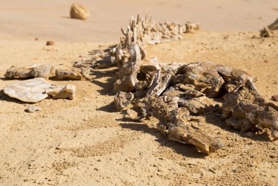
Meanwhile, Prime Minister Ahmed Nazif received a report from Maged George State Minister for Environmental Affairs on this area, asserting that this are houses several geological components, water springs, and rare fossils as well as a great
the number of whales’ skeletons dating back to 40 million years.
Nazif has decided to form a committee of the ministries of higher education, environmental and foreign affairs, Fayoum governorate in addition to a number of Egyptian university experts to take part in drawing up a comprehensive plan for boosting investment in the natural and archaeological sites in Fayoum governorate.
An article of Al Ahram weekly on Egypt, Environment, 08/20/2005
Fayyoum is currently the focus of interest and cooperation between the governorate of Fayyoum and the ministries of environment and tourism. The plan of cooperation aims at transforming Al Fayyoum into an Eco-Tourism region, due to its unpolluted environment and agriculture, folk and local handicrafts as well as its overall cultural heritage. Al Fayyum has been known for being rich in its cultural and natural resources such as Lake Qaroun and Wadi Al Rayyan, as well as the city of Madi, which was built in the second
Program includes:
Transfer from Cairo to / EL Fayoum Wadi El Hittan- Cairo by Jeep 4WD Private car
Full day trip with lunch box.
program excludes:
tips.
Insurance of any kind
item NOT mentioned in our offer
Recommend Tour Packages
